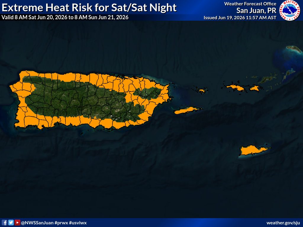
Saturday Will Be Partly Cloudy, Scattered Showers, Breezy, Hazy, 87°F – EXCESSIVE HEAT –
Updated 6/19/26 at 8:41 p.m. AST
Weather updates are posted by Jesse Daley, who has been reporting on weather for the Source since 2022 and holds an Undergraduate Certificate in Weather Forecasting from Pennsylvania State University.
VI SOURCE WEATHER UPDATES
! A NEW Weekly Weekly Weather Video is available here!
! VI Source article: 2026 Atlantic Hurricane Season Officially Begins as Forecasters Urge Continued Preparedness
SATURDAY’S WEATHER FORECAST: 6/20/26
Happy Saturday!
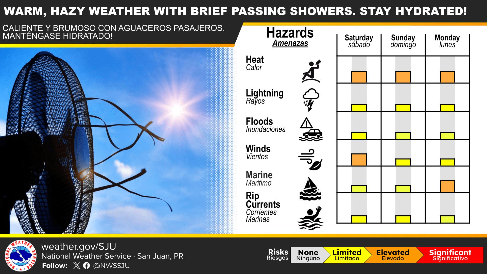
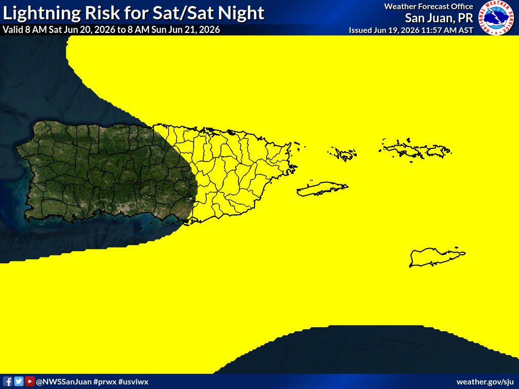
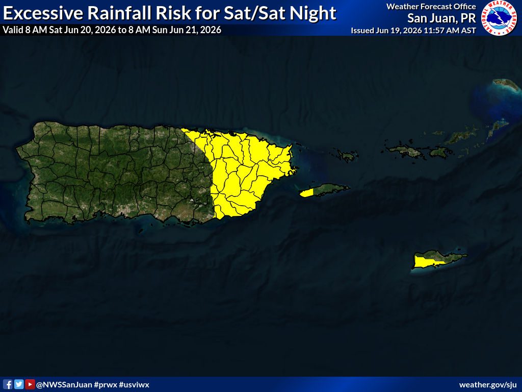
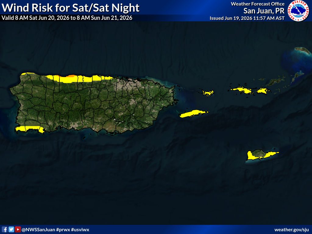
According to the National Weather Service (NWS), the weather in San Juan, Puerto Rico, Saturday is forecast to be partly cloudy, with a chance of scattered showers. The sky will be hazy as Saharan dust will be prevalent across the islands. The temperature is forecast to rise to around 87°F (30.5°C), and the heat index is expected to continue to be high; heat alerts could be issued. Winds will be gusty, coming from the east, at approximately 16 mph, with gusts reaching 21 mph. The chance of rain on Saturday is 30%.
For Saturday night, conditions are expected to be partly cloudy, hazy due to Saharan dust, and with isolated showers. The low temperature is forecast to fall to about 78°F (25.5°C). Winds will be gusty, coming from the east, at approximately 20 to 22 mph, with gusts reaching 28 mph. The chance of rain on Saturday night is 20%.
“Seasonal to warmer conditions are likely this Father’s Day weekend and early next week, with heat indices ranging from the mid-90s to mid-100s Fahrenheit across urban and low-lying areas of Puerto Rico and the U.S. Virgin Islands. Moderate to high concentrations of Saharan dust will spread across Puerto Rico and the U.S. Virgin Islands through this holiday weekend and early next week, with mainly hazy skies that will reduce visibility and deteriorate air quality. Sensitive groups must follow medical recommendations. Shower and thunderstorm activity expected to increase on Father’s Day, resulting in ponding of water over roadways and urban and small stream flooding over portions of the U.S. Virgin Islands and Puerto Rico,” the NWS said.
Additionally, fire weather conditions could occur.
“Looking ahead to Saturday, the elevated-to-critical fire weather threat is expected to persist, with little to no relief. The ongoing inflow of a dense Saharan Air Layer will maintain an exceptionally dry mid-level air mass, capping deep vertical moisture and enhancing intense daytime heating across the region. As a result, afternoon relative humidity values are once again forecast to drop near 50% or lower across the southern slopes of Puerto Rico and St. Croix. When combined with sustained easterly trade winds remaining around 15 to 20 mph and further drying of already critical fuels, an enhanced fire danger will remain a primary concern on Saturday. Additional fire weather alerts may be required Saturday morning if conditions align as expected,” the NWS explained.

Yellow = Limited Risk Orange = Elevated Risk Red = Significant Risk
Yellow = Limited Risk Orange = Elevated Risk Red = Significant Risk
Yellow = Limited Risk Orange = Elevated Risk Red = Significant Risk
Yellow = Limited Risk Orange = Elevated Risk Red = Significant Risk
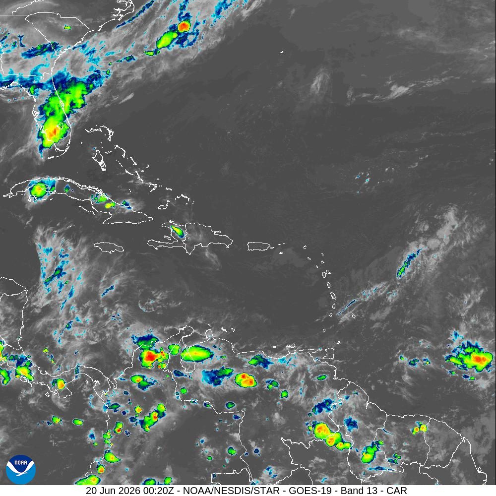
Below: Infrared satellite imagery obtained at 8:20 p.m. AST on Friday indicates a partly cloudy sky across the USVI. Precipitation is possible.
MARINE WEATHER UPDATE
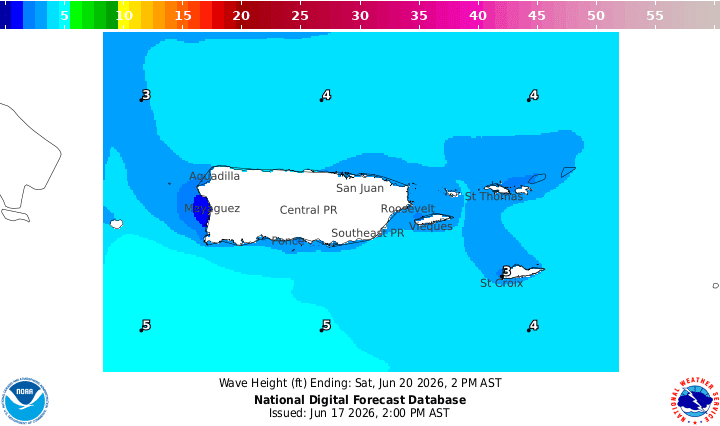
National Weather Service forecasters report that wave heights on Saturday are expected to build from between 3 and 5 feet.
The NWS provided the following details:
“A broad surface high pressure building over the Central Atlantic will continue to promote moderate to locally fresh east to east- southeast winds over the next several days, resulting in choppy seas across local waters and Caribbean passages; small craft should exercise caution. A dense layer of Saharan dust will continue to filter into the region through the holiday weekend, resulting in hazy skies, reduced visibility, and poor air quality. A tropical wave is expected to approach the local area by Sunday morning, with showers and isolated thunderstorms likely to move across regional waters,” the NWS explained.
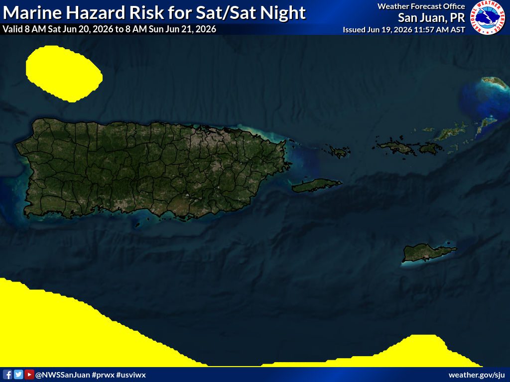
Yellow = Limited Risk Orange = Elevated Risk Red = Significant Risk
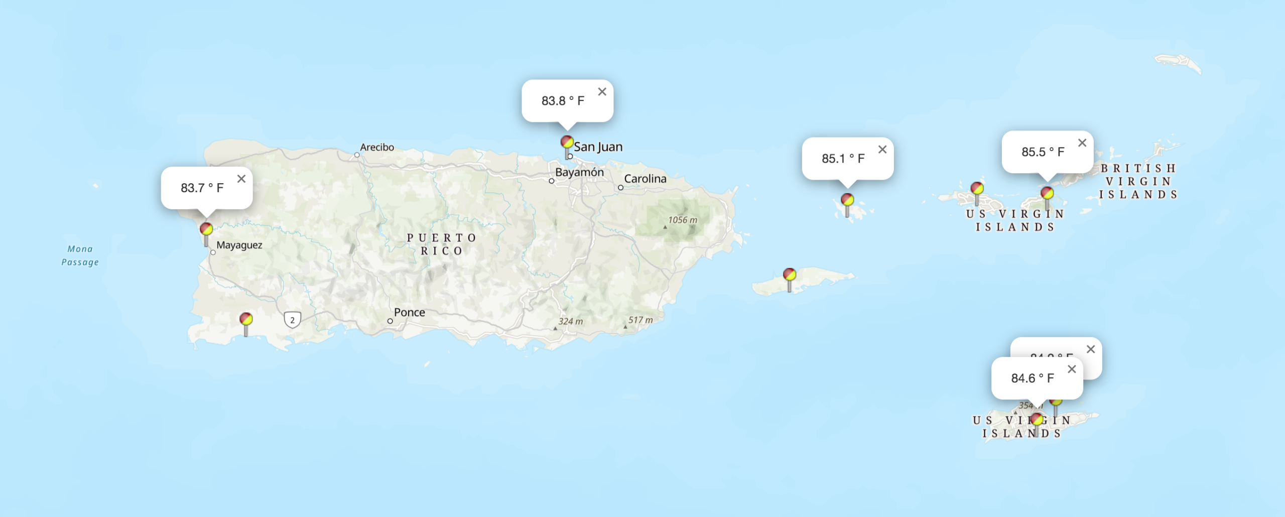
The water temperature is approximately 84°F, roughly 28-29°C.
NOAA Ocean Water Temperature Map: 6/18/26:
Risk of Rip Currents:
The NWS explained that the risk of rip currents is projected to be moderate across the USVI on Saturday.
The NWS provided the following details:
“The moderate risk of rip currents continues across the northern and eastern exposed beaches of Puerto Rico, including Vieques and Culebra, and St. Croix in the U.S. Virgin Islands, with a low risk elsewhere. Beachgoers must exercise caution, as life-threatening rip currents are possible along the beaches under the moderate risk. This holiday weekend, the threat will gradually spread across the islands as winds continue to strengthen, with most beaches of the islands under moderate risk. Aside from rip currents, residents and visitors are encouraged to follow the latest weather forecast, as afternoon showers and isolated thunderstorms can be expected this holiday weekend and early next week, particularly near coastal areas of western/northwestern Puerto Rico. Beachgoers must exercise caution, as gusty winds can be expected, and lightning cannot be ruled out. Moderate to high concentrations of Saharan Dust will continue to filter into the region through the holiday weekend and persist early next week, resulting in hazy skies, reduced visibility, and poor air quality. Beachgoers sensitive to these particles should follow medical recommendations,” the NWS said.
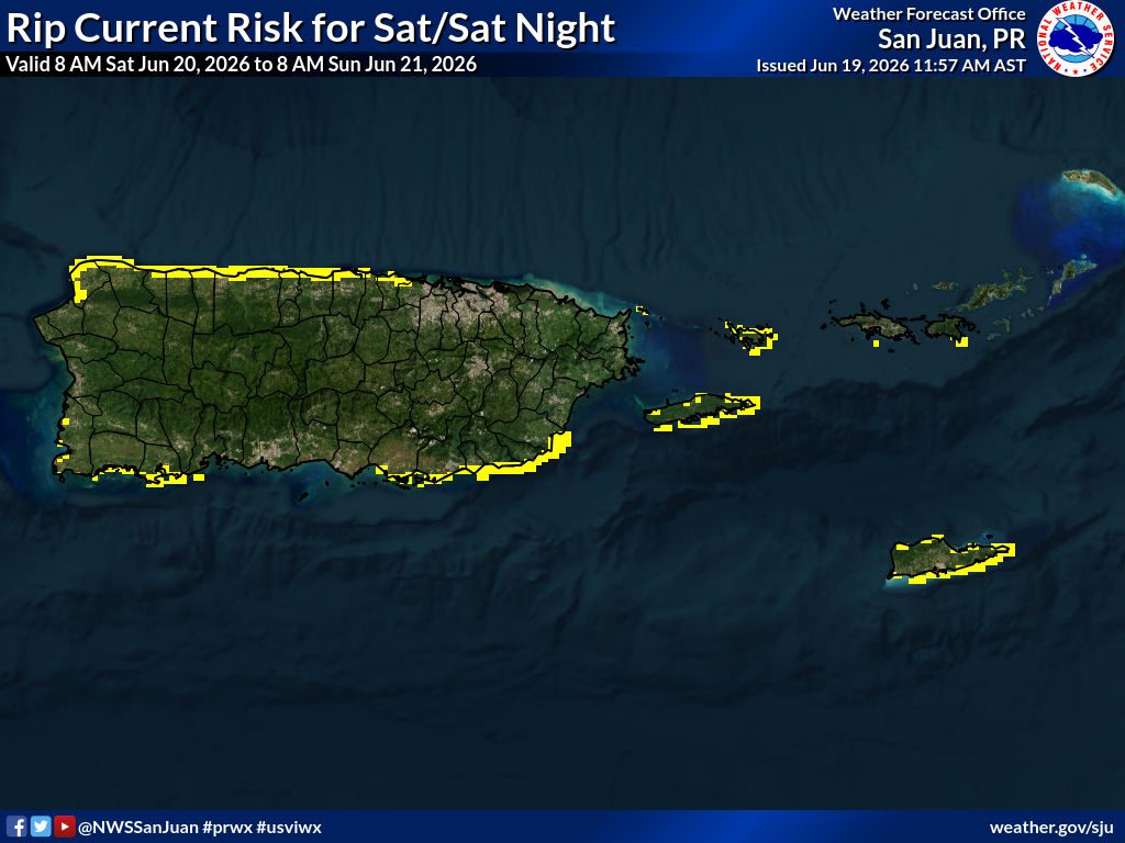
Clear = Low Rip Current Risk Yellow = Moderate Rip Current Risk Red = High Rip Current Risk
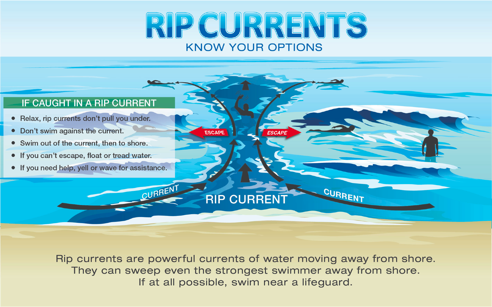
The NWS reminds swimmers that even when there is a lower risk of rip currents, they “can still form near structures like groins, jetties, reefs, and piers.” More information is available here.
Swimmers are encouraged to exercise caution and understand how to escape the pull of a dangerous rip current.

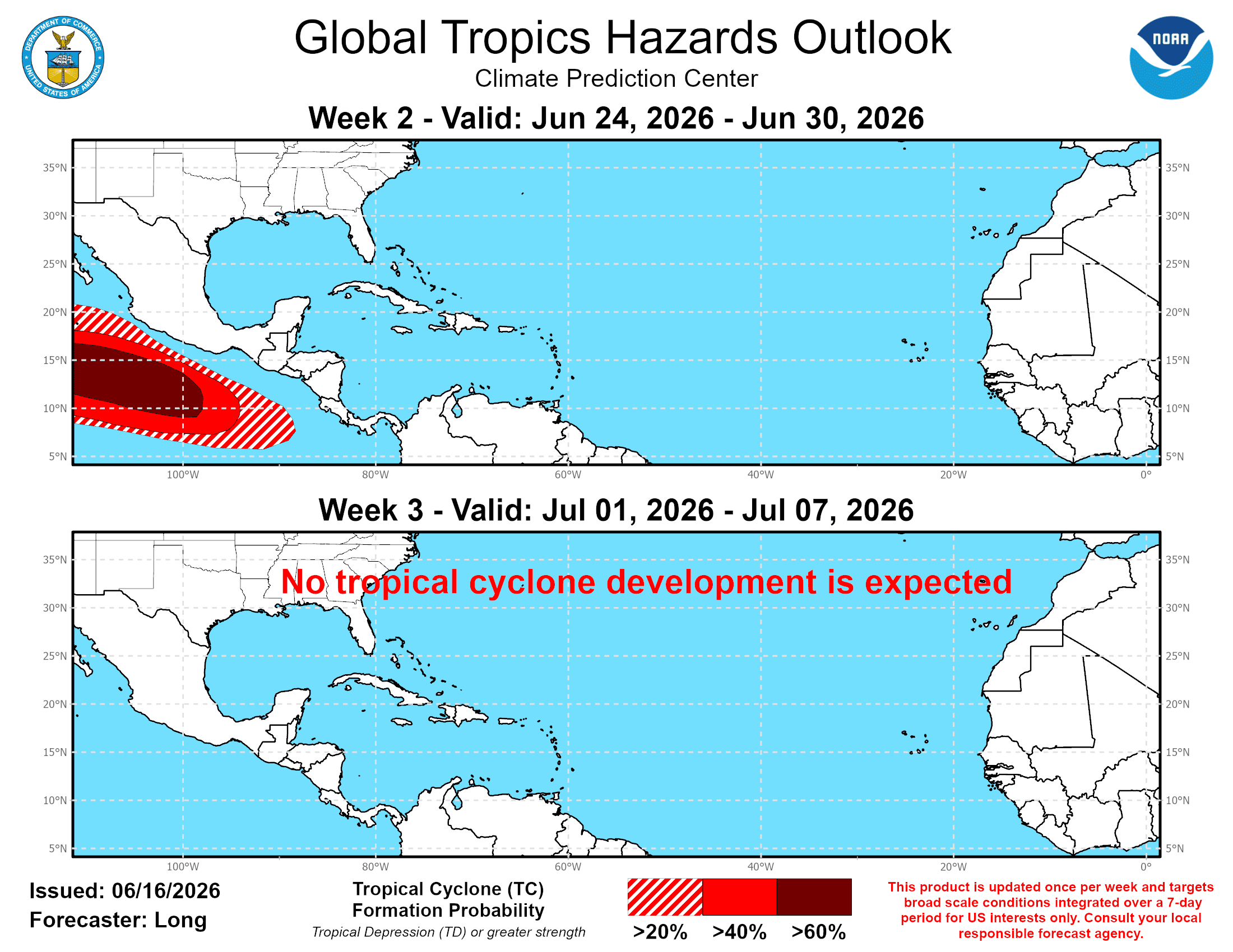
TROPIC WATCH
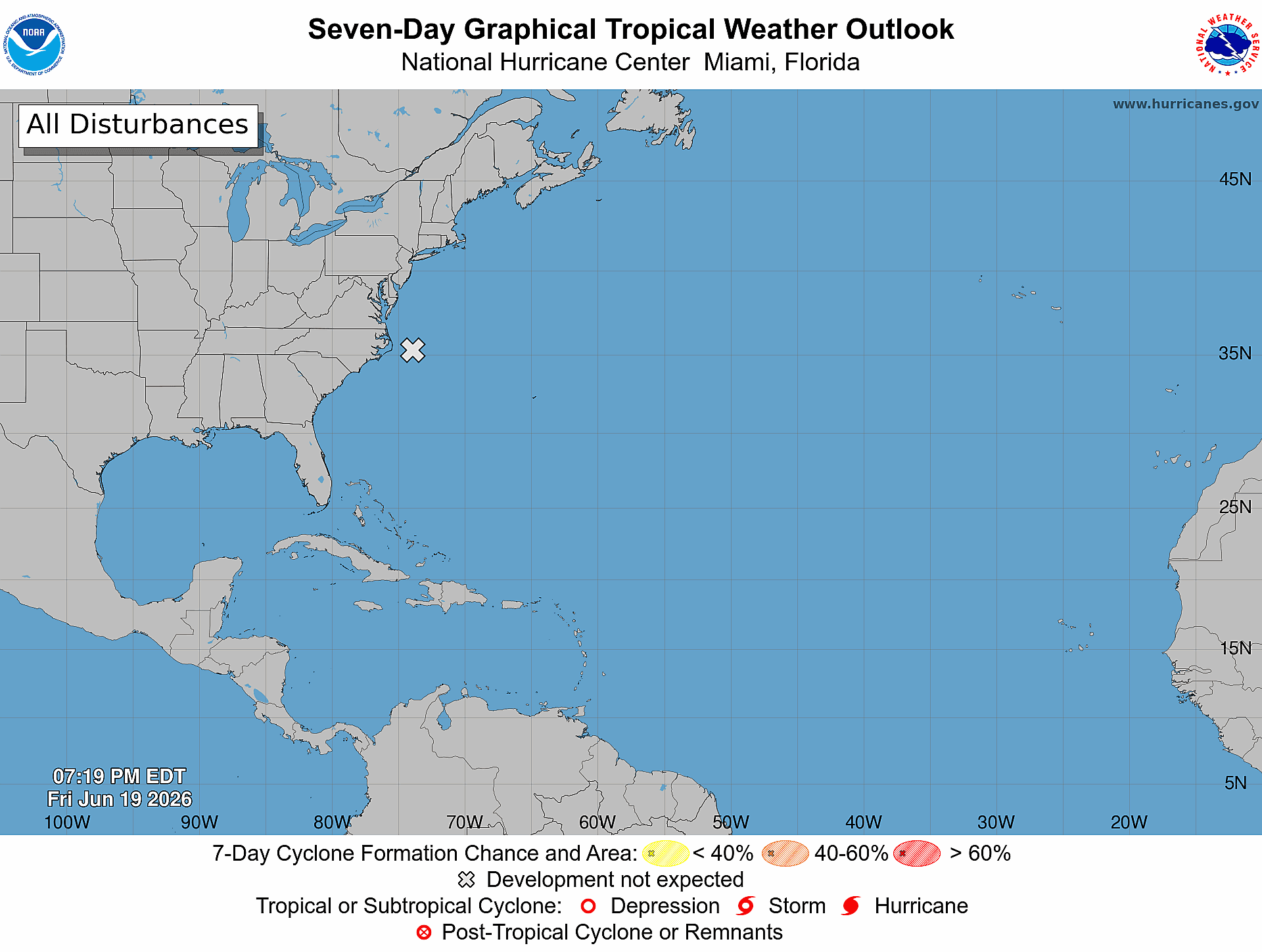
Tropical Activity:
The 2026 Atlantic hurricane season began on June 1, 2026, and will run until Nov. 30.
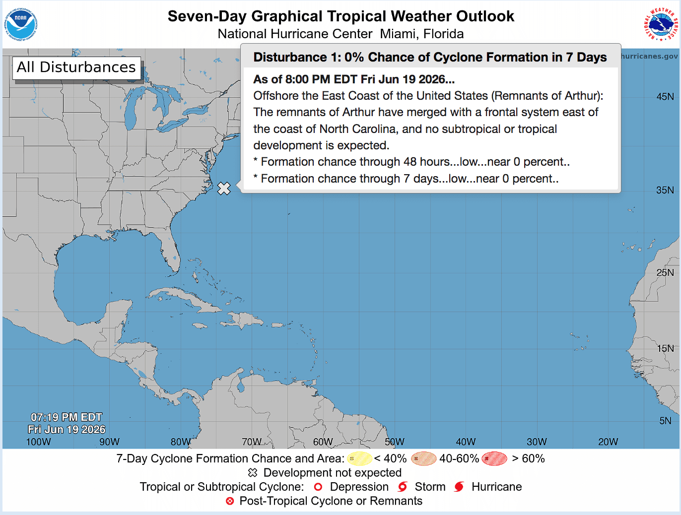
The National Hurricane Center is monitoring the remnants of Tropical Storm Arthur, the first-named cyclone of the 2026 Atlantic hurricane season. The system is not expected to experience further development.

VI Source article: NOAA Outlook Calls for Below-Normal Atlantic Hurricane Season, But Preparedness Remains Critical
VI Source article covering AccuWeather’s 2026 Atlantic hurricane season forecast is available here!
Additionally, a VI Source article covering Colorado State University’s 2026 Atlantic hurricane season forecast is available here!
Super Typhoon Sinlaku recently caused extreme damage to the U.S. territories of Guam and the Northern Mariana Islands. Read more and learn how to help in a VI Source article here.
OBSERVATIONS
Sunrise: 5:45 a.m.
Sunset: 6:59 p.m.
Preparation for extreme weather events in the Caribbean, such as earthquakes and tropical cyclones, is important. Residents and visitors in the USVI are encouraged to stay updated on weather events on the V.I. Source Weather page and sign up for alerts from the National Weather Service and the Virgin Islands Territorial Emergency Management Agency.
Article Series: “Extreme Weather in the Caribbean”
- Part 1: Caribbean Earthquakes and Tsunamis
- Part 2: Caribbean Volcanoes
- Part 3: Rip Currents
- Part 4: Hurricanes
- Part 5: Wildfires
- Part 6: Flash Floods
- Additional articles about earthquakes in the Caribbean are available here and here!
- From Calm to Catastrophic: The Threat of Rapid Hurricane Intensification
- Three Decades After Marilyn, Forecasting and Emergency Preparedness Have Evolved in the USVI
- Please remain prepared for earthquakes and flash flooding across the USVI.
- Three Decades After Marilyn, Forecasting and Emergency Preparedness Have Evolved in the USVI
An on-camera interview between Source weather reporter Jesse Daley and Daryl Jaschen, the director of VITEMA, is available here!